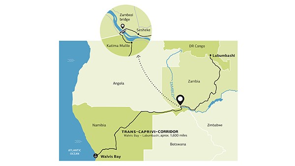
The minefields at the heart of Africa are over a 1,600-mile journey from Namibia’s Atlantic coast. For Namibia, the bridge over the Zambezi at Katima Mulilo is a symbol of freedom and cornerstone of economic development.
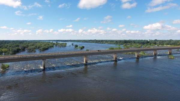
Slender passage over the mighty Zambezi
Christian Grün from the German Embassy in Windhoek explains the bridge’s significance for the development of Namibia (KfW Group/Thomas Schuch). This video is only available in German.
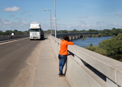
Many of the lorries on the Trans-Caprivi Corridor (also known as the Trans-Zambezi Corridor) carry copper by the ton. The highway connects the minefields in the Copperbelt of Zambia and the Democratic Republic of the Congo to the deep-sea port of Walvis Bay in Namibia. The truck drivers need patience to do their job. The route between the major Congolese city of Lubumbashi and the Atlantic coast is 1,671 miles (2,690 kilometres) long, with almost half of this stretching across Namibian terrain. It takes between four and five days behind the wheel to cover the entire distance.
The Zambezi is where the truckers both leave and return, needing as they do to take their heavily loaded lorries across Africa’s fourth longest river. After reaching the Namibian border town of Katima Mulilo, they drive over a bridge; the only one for many miles around. This was built between 2002 and 2004 with the aid of KfW as the final piece to connect the Trans-Caprivi Corridor.
The highway, now fully linked up thanks to the bridge, is immensely important to Namibia’s economy. In the years ahead, the country is hoping to internationally position itself as a logistics hub for Southern and Central Africa with its port at Walvis Bay and the neighbouring airport. The natural resources within its borders may include diamonds, uranium ore, copper and zinc, but these cannot guarantee a long-lasting economic boom. “Namibia is preparing for the time after the mines,” says Uwe Stoll, Director of the KfW Office in Windhoek.

“The bridge has symbolised Namibia’s quest for independence like no other structure.”
Strategically valuable
Those looking to travel from the mining areas in the Copperbelt to the deep-sea Atlantic port of Walvis Bay must cross the Zambezi. This is what gives the bridge such economic importance for the region.
The bridge’s construction has a long history, which is closely tied to one man: Klaus Dierks. The chief bridge engineer in Namibia’s Department of Transport started planning a bridge over the Zambezi back in 1982. All the important road connections without exception had run through South Africa at that point, he wrote on his website, which has stayed up after his passing in 2005 and documents his numerous projects.
Dierks found supporters in the independence movement SWAPO. South Africa had held a League of Nations mandate over Namibia since 1920 and in practice treated the country as a colony. However, as Zambia was considered an enemy of the South African ruling powers, they regarded this unapproved bridge planning as treason and summarily relieved the engineer of his official duties in 1986.
The bridge construction plans could only progress after Namibia’s Independence Day on 21 March 1990. The nation’s first free and universal elections saw Dierks become a SWAPO representative in Parliament. In addition, President Sam Nujoma appointed him as deputy minister for public works. But before the engineer could create his structure to connect to the centre of the African continent, the road would have to be finished.
Read more under the image gallery.
Shapeshifter
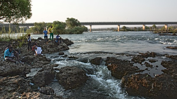
At the border between Namibia and Zambia, the Zambezi is wide, shallow and calm. Hard to imagine that around 120 miles (200 kilometres) downstream, it cascades down – at the famous Victoria Falls, no less.

Key crossing
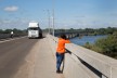
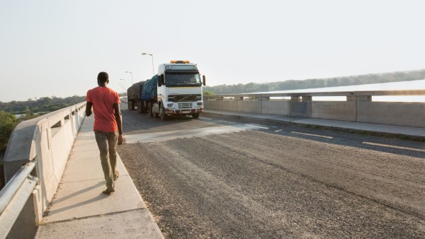
The road that crosses the Zambezi Bridge is the only one for hundreds of miles around to cross the Zambezi, Africa’s fourth longest river.
Dierks negotiated with parties including Germany for financing of the then missing part of the road. The German Federal Government granted the funds for the highway. In 1998, the Namibian government, the German Federal Ministry for Economic Cooperation and Development (BMZ), and KfW agreed on a financing plan for the Zambezi Bridge. In the end, it was constructed in partnership with the neighbouring country of Zambia and put together just over the border in Zambian territory. This made the financing easier and by 2004, it had opened. “The bridge has symbolised Namibia’s quest for independence like no other structure,” Klaus Dierks wrote in his online article.
A look back into the history books charts this long path to independence. And the inglorious role that Germany played soon becomes apparent to anyone who reads up on the Zambezi Bridge. The bridge crosses the Zambezi River, which forms a natural border between the Namibian Caprivi Strip and Zambia. The name “Caprivi” hails from the colonial history of Namibia, when the country was still called German South West Africa. Georg Leo von Caprivi, Bismarck’s successor as chancellor of Germany, acquired this panhandle of land in 1890 as part of a quid pro quo deal. In exchange, he relinquished the territorial claims over the East Coast of Africa, including the island of Zanzibar, to the British Empire.
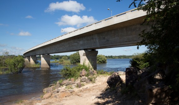
Past the rapids
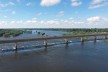
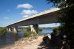
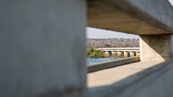
The 2,877-foot (877-metre) long bridge makes a sweeping arc past the rocks of the Katima Rapids.
The colonial masters promised to no avail that the land acquisition in German South West Africa would pave the way for access to the Zambezi. But their hopes were dashed as the region proved too remote for the ruling powers to be able to exert their influence from the central Namibian city of Windhoek. Rumours of possible coal, diamond and copper reserves did prompt an expedition to the Caprivi Strip in 1909, and the German flag was hoisted at Schuckmannsburg by the shore of the Zambezi. There came no sign of the minerals, however. In 1915, the German Schutztruppe (“protection force”) lost their control over the colony to the Union of South Africa following a series of battles, which were fierce at times.
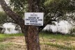
The German Empire’s legacy in German South West Africa casts many dark shadows. Notorious among them is Lieutenant-General Lothar von Trotha’s order against the Herero rebels on 2 October 1904: “Any Herero found inside the German frontier, with or without a gun or cattle, will be executed.” The armed conflicts – first with the Herero, then later with the Nama – had devastating consequences. According to historians’ estimates, tens of thousands of Herero and thousands of Nama died in conditions of conflict, flight, displacement, prison camp detention and forced labour. Germany is now looking for ways to confront its special responsibility. Norbert Lammert, president of Germany’s lower house of parliament, the Bundestag, identified the colonial-era crimes as a genocide for the first time in July 2015.
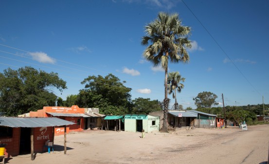
Better connected
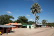
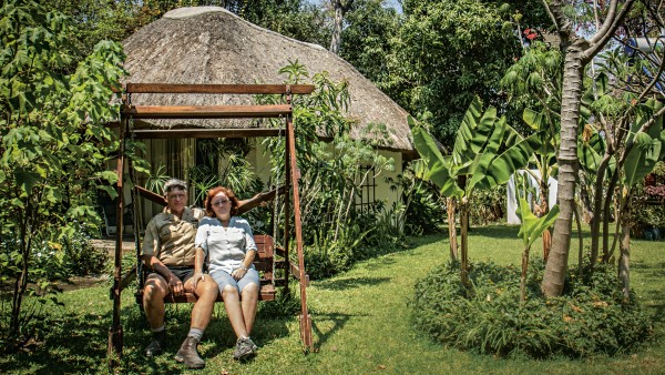
Mary Rooken-Smith and her husband Keith run a lodge together in Katima Mulilo. More tourists have been coming to the region since the bridge has been around.
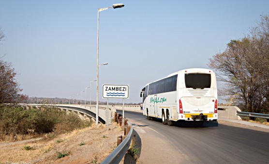
A hundred years on from the German troops’ surrender, some place names in the country will still sound familiar to a German ear. Although this is clearly changing. Since 2013, Schuckmannsburg was restored to its former name, Luhonono, and the Caprivi Strip is now officially known as the Zambezi Region. Namibia is breaking free from the chains of the past. And opening the door to the future.
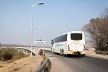
Two hundred lorries now cross the border between Namibia and Zambia every day. But long-haul truckers are not the only travellers to be encountered on the road. Over the past year at the Wenela border post, 1,500 vehicles were counted daily. Mary Rooken-Smith runs a lodge for tourists lodge for tourists just three miles (five kilometres) away. “Since the bridge has opened, we have seen a flood of visitors here in the region,” she reports.
Before the bridge, tourists had to cross the Zambezi by ferry at Kazungula, which is over two and a half hours’ drive away, not including the time the ferry crossing would take. Travelling in the region is now significantly easier. “Effective infrastructure is needed to make developments like this a success. The bridge plays a crucial role in that,” says Gitta Paetzold, CEO of the Hospitality Association of Namibia.
“Namibia has the opportunity to become a logistics hub.”
Little competition
The Zambezi is 1,599 miles (2,574 kilometres) long. Yet only 12 bridges connect its shores.
However, the construction of the port of Walvis Bay on the Atlantic is of even greater economic significance. “The bridge has opened up a great many opportunities,” says Johny Smith of the Walvis Bay Corridor Group, who works to market the port and surrounding infrastructure. As Zambia did before, Botswana has built major freight centres at Walvis Bay. The areas operate as exclaves within Namibian territory.
Logistics firms from Zambia and Botswana can now use their own facilities on site for customs clearance, container handling and storage of their goods. The port of Walvis Bay is already one of the most efficient in Africa. “Namibia has the opportunity to become a logistics hub for private enterprises and establish itself as an alternative trade route in Southern and Central Africa,” Smith states.
The aim of becoming a logistics hub moves Namibia a step further towards economic independence from its neighbour, South Africa (which maintains the continent’s largest container port in Durban), rising to become a serious competitor.
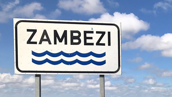
Changing lifeline
The Zambezi rises in Zambia. From trickling stream to raging river, it flows through six countries before emptying into the Indian Ocean in Mozambique.
The Namibian government aims to reach the level of development of an industrialised country within 15 years as part of its Vision 2030. Over the 2012 to 2017 period, the National Planning Commission has been concentrating on transport infrastructure. “This is laying the foundations for decisions in favour of larger infrastructure projects,” says Uwe Stoll.
The port of Walvis Bay’s expansion is of particular interest here, as future plans see it dealing with the ocean liner category of container ships, as well as offering maximum turnaround times of 24 hours. Rail links to Angola, Botswana and Zambia are also on the agenda. On behalf of the German Federal Government, KfW is also negotiating with the Government of Namibia about the financing of future projects, including a railway line to boost the Trans-Caprivi Corridor.
“The goal is to move as much freight as possible by rail,” Stoll states: “That is more economically efficient. Most of all because the heavy goods traffic substantially shortens the roads’ service life. Rehabilitating and renovating these is associated with high costs.”
SOURCE
This article appeared in the autumn/winter 2015 issue of CHANCEN magazine focusing on bridges.
To German editionInstead, the aim is to rehabilitate a section of railway dating from the colonial era running between the port of Walvis Bay and the north-central part of the country. With the north holding the largest industrial and commercial centre after Windhoek, this is a project of great importance. It may even be possible at a later stage to extend the railway line to the neighbouring countries of Angola, Zambia and the Democratic Republic of Congo, Stoll adds: “It is clear to see that there will be a large number of major projects launching in the years to come.”
Published on KfW Stories: Wednesday, 3 May 2017
The described project contributes to the following United Nationsʼ Sustainable Development Goals
Goal 8: Promote inclusive and sustainable economic growth, employment and decent work for all
The economic growth of the past decades has come at the expense of natural resources and the global climate, and has long since reached ecological limits. If all people were to be given access to the quality of life that people accept as a matter of course in Germany, several planet Earths would be required to sustain it. Sustainable economic development reconciles social, ecological and economic development goals.
All United Nations member states adopted the 2030 Agenda in 2015. At its heart is a list of 17 goals for sustainable development, known as the Sustainable Development Goals (SDGs). Our world should become a place where people are able to live in peace with each other in ways that are ecologically compatible, socially just, and economically effective.
Data protection principles
If you click on one of the following icons, your data will be sent to the corresponding social network.
Privacy information